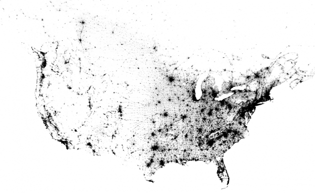
The east side of the country sure is a lot more densely populated that the west.
This is a map of every person counted by the 2010 US and 2011 Canadian censuses. The map has 341,817,095 dots – one for each person.
Source: bmander.com
The east side of the country sure is a lot more densely populated that the west.
This is a map of every person counted by the 2010 US and 2011 Canadian censuses. The map has 341,817,095 dots – one for each person.
Source: bmander.com
Hey, look – there I am! 😉