A deluge of torrential rains has lashed the Lone Star State for more than a month—making June one of the wettest ever recorded in Texas.
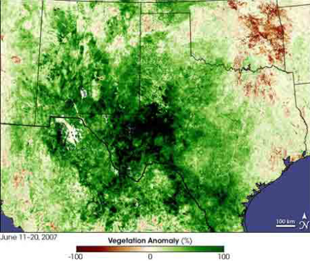
The rains spurred Texas’ grassy plains to bloom dense vegetation, as seen in a photograph taken by a NASA satellite between June 11 and June 20.
The deep, emerald green indicates regions where plants are growing more quickly or robust than average, and the dark, almost-black color marks where vegetation was most dense.
Brown spots point to clouds or water on the ground, which in some cases may mask plant growth.
About 48,000 square miles (124,319 square kilometers), an area the size of Mississippi, was pounded by rains. Texas, Oklahoma, and Kansas were hit with more than 330 percent of their average rainfall. In Texas, every major river basin flooded, an event that had not occurred since 1957, according to the Associated Press.